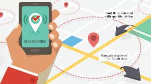
Set a geo-fence and you will get an alert message when the device exits the range of fence. This gives one a peace of mind.

Geofencing is a location-based service that uses GPS (Global Positioning System), RFID (Radio Frequency Identification), Wi-Fi, cellular data or combinations of the above to determine the location of the device that is being tracked.
In most cases, the tracking device is a smartphone, computer, or watch. It can also be a device designed specifically for a pretty wide variety of situations. Some more examples can include dog collars with built-in GPS tracker, RFID tags used to track inventory in a warehouse, and navigation systems built-in to cars, trucks, or other vehicles.
The location of the device being tracked is compared against a virtual geographic boundary usually created on a map within the geofence app. When the device being tracked crosses the geofence boundary it triggers an event defined by the app. The event may be to send a notification or perform a function such as turn on or off the lights, heating or cooling in the designated geofenced zone.
How Geofencing Works
Geofencing is used in advanced location-based services to determine when a device being tracked is within or has exited a geographic boundary. To perform this function the geofencing app needs to be able to access the real-time location data being sent by the tracked device. In most cases, this information is in the form of latitude and longitude coordinates derived from a GPS enabled device.
The coordinate is compared against the boundary defined by the geofence and generates a trigger event for either being inside or outside the boundary.
